|
|
|
| Map | Satellite | Combined |
Rising seas, caused by global warming, have for the first time washed an inhabited island off the face of the Earth ... Lohachara island, in India's part of the Sundarbans where the Ganges and the Brahmaputra rivers empty into the Bay of BengalThis is nothing but a lot of hype (though The Independent is simply reporting what Indian "scientists" reported).The disappearance of Lohachara, once home to 10,000 people, is unprecedented.
The Sundarbans delta is the largest mangrove forest in the world.During each monsoon season almost all the Bengali delta is submerged, much of it for half a year.
One of the greatest challenges people living on the Ganges Delta may face in coming years is the threat of rising sea levels caused mostly by subsidence in the region ...
Lohachara Island was an islet which was permanently flooded in the 1980s.Considering the fact that these "islands" are in fact mangrove stabilized sandbars and/or mud flats in a major river delta that has annual monsoons and frequent cyclones, it is not at all surprising that some "islands" will disappear ... or that new ones will appear. This type of behavior has been recorded in coastal regions all over the Earth for thousands of years ... to assume that "Global Warming" is the only cause for this case - the flooding of Lohachara Island - is complete nonsense.The definite disappearance of the island was reported by Indian researchers in December 2006
The islet is one of a number of "vanishing islands" in India's part of the delta: in the past two decades, four islands – Bedford, Lohachara, Kabasgadi and Suparibhanga – have been permanently flooded and 6,000 families have been made homeless.
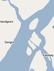
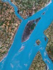
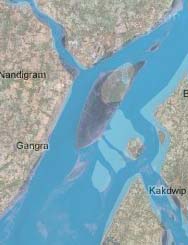
These satellite photos (thumbnails below) show that Lohachara Island did not sink ... it simply no longer exists. It was washed away. Notice that the adjacent island (to the north) is now twice the size indicated by the map. (Toggle between Map and Satellite.)
Based on this photo, it appears that storms were the cause because it is not possible to see the outline of the island indicated on the map. If it was subsidence (or rising sea levels), then the outline of the island should still be visible. If it was Global Warming, then ALL the delta islands of the Ganges Delta, Mississippi Delta, and many other deltas would have also been lost ... and that is NOT what happened.
This story has been repeated, mostly verbatim, by a number of small newspapers and online sources. The fact that they would repeat such nonsense as a statement of fact indicates that nothing they write should be considered as trust worthy.
The Hindustan Times quotes Dr Sugata Hazra, Director of School of Oceanographic Studies at Jadhavpur University, as saying
"The mangrove cultivation was extensively damaged till 1990s by humans but not much effort went into its re-plantation"In other words, the primary source of the story (Dr Hazra) blames local people for most of the problem ... but none of the British or US articles repeat that quote.
|
|
|
|
| Map | Satellite | Combined |
This map indicates that Ghoramara Island is the furthest north of the three.
If you zoom in on the original satellite image, it appears that there is actually a channel where the 3 sandbars (islands) use to be.
|
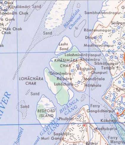
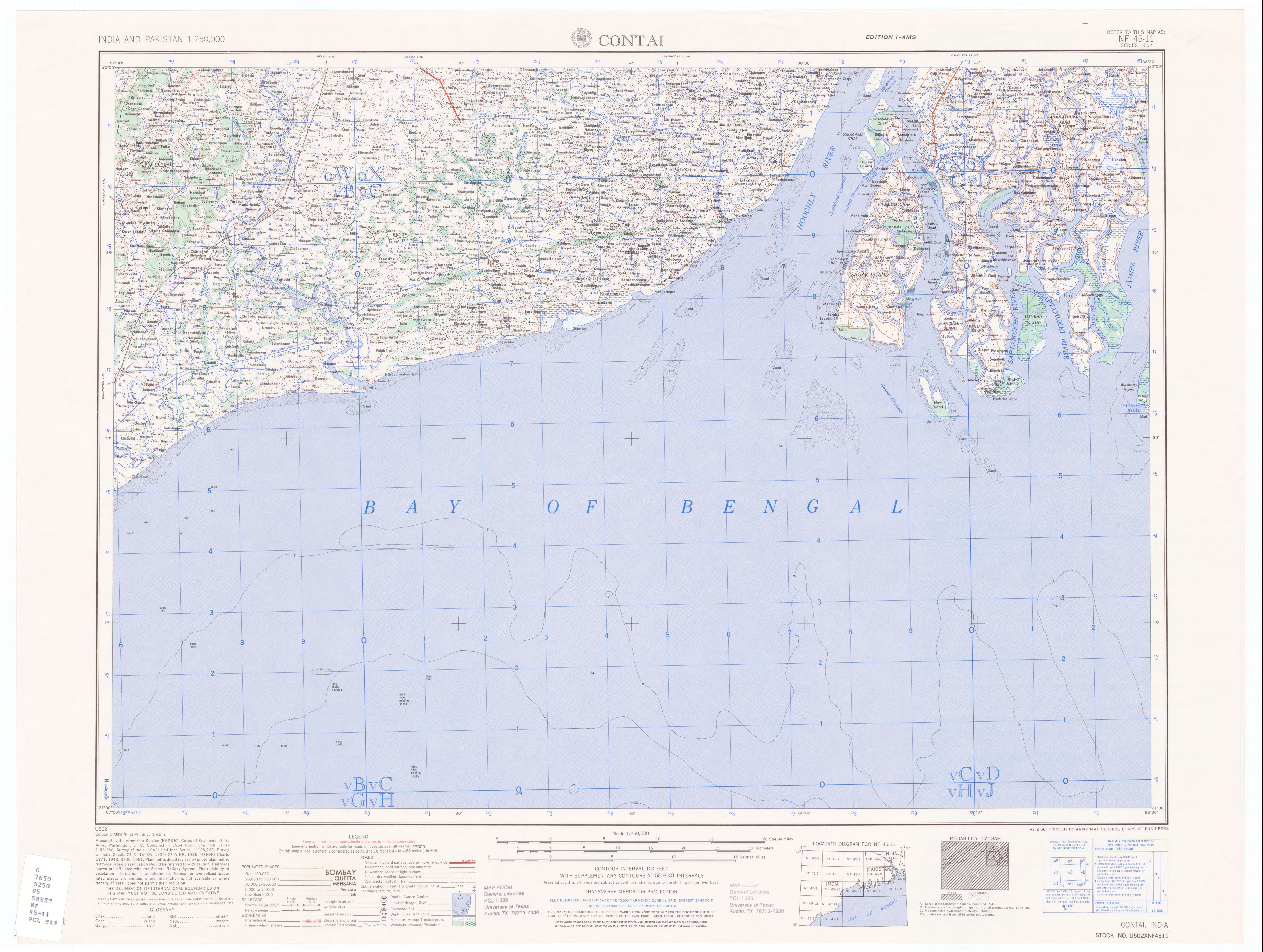
This image is from a
1954 official U.S. Army map - it shows more detail than Google ... including the island names.
(wiki mirror)
The map key does not say so, but the pink/orange crossed lines appear to represent dikes. (See the original map for a better overview.) The part of Ghoramara Island surrounded by a dike is still there. The fact that the currently missing parts of Ghoramara Island and all of Lohachara Island and Bedford Island were NOT surrounded with dikes in 1954 indicates to me that these sand bars were too low to be worth protecting at that time. Notes
|